
Bridges, Sensors, and Innovation Deals This Week
DOT Tech News
August 31, 2026 · Transportation Technology Briefing
Good morning, DOT tech nerds and professionals. This week we're looking at a massive infrastructure and ITS overhaul on two major freight corridors in Mississippi, a federal open-source tool turning intersections into real-time digital twins, and Montana DOT locking in a multi-year deal to push tech innovation forward. Good stuff across the board.
In this week's DOT Tech News:
- Mississippi DOT's "The Big Fix" Brings ITS Tech and 36-Bridge Overhaul to Critical I-20/I-55 Freight Corridors
- Federal Lab's Open-Source Sensor Fusion Tool Gives Intersections a Real-Time Digital Twin
- Montana DOT Signs Multi-Year Tech Innovation Deal With Infrastructure Testing Nonprofit the Ray
Mississippi DOT's "The Big Fix" Brings ITS Tech and 36-Bridge Overhaul to Critical I-20/I-55 Freight Corridors
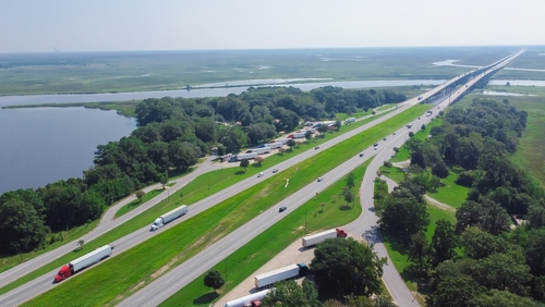
Mississippi DOT launches one of its largest-ever infrastructure investments this fall, combining structural bridge rehabilitation with Intelligent Transportation System technology across two of the state's busiest freight corridors.
The $-scale project targets I-20 and I-55 through the Jackson metro area — routes that have carried commercial freight and commuter traffic for over 60 years. Work covers 36 bridges (decks, beams, girders, epoxy joints, and bearing replacements), 32 miles of resurfaced interstate, and new ITS installations that will deliver real-time travel data to drivers. The project also touches I-220 and U.S. 51 segments.
Vendors and agency planners should flag two 45-day full interstate shutdowns on I-20, the first scheduled for summer 2026. MDOT chose full closures deliberately — the alternative, phased lane closures, would have stretched the timeline from days into years. Through the rest of 2025, most work runs nights and weekends with minimal traffic impact. MDOT Executive Director Brad White committed to advance notice, marked detours, and public information campaigns before each shutdown.
The ITS component makes this more than a pavement project — agencies evaluating real-time traffic management tools and freight corridor modernization strategies have a live, large-scale deployment to watch.
Source: U.S. Department of Transportation
Federal Lab's Open-Source Sensor Fusion Tool Gives Intersections a Real-Time Digital Twin
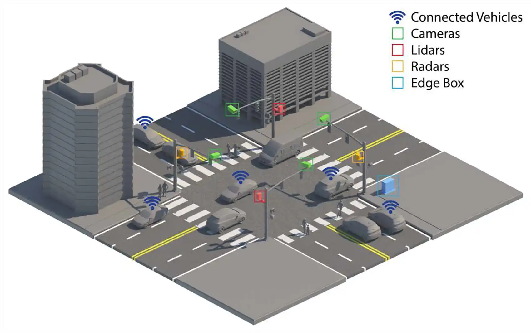
Researchers at the National Laboratory of the Rockies have built an open-source toolkit that fuses camera, lidar, radar, and connected-vehicle data into a live digital twin of intersection activity — and they're now shopping it for licensing.
The tool, called IPC-Fusion, mounts sensors on traffic signals and nearby buildings to create a blind-spot-free view of every vehicle and pedestrian at a signalized intersection. NLR is already in discussions with a major traffic solutions provider to bring it to market. The system targets signal timing optimization, adaptive signal control, congestion reduction, and pedestrian safety analysis.
The stakes are real. Intersections contribute to nearly 25% of all U.S. traffic fatalities and half of all traffic injuries. The Federal Highway Administration estimates that optimized signal timing alone can cut delays by 15–40% and fuel consumption by up to 10%. With 40,000 annual traffic deaths and $300 billion in economic losses nationwide, intersection tech is one of the highest-leverage targets in transportation safety.
NLR frames IPC-Fusion as foundational infrastructure for automated mobility — a system where vehicles and roadside infrastructure share a common operating picture. A signal could detect a single car waiting at an otherwise empty intersection and adjust timing in real time, eliminating unnecessary delays.
Why it matters: State and local DOTs evaluating smart intersection investments now have a federally developed, open-source option entering the commercial market — one built explicitly around the sensor and data standards that AV and V2X programs already require.
Source: U.S. Department of Transportation / National Laboratory of the Rockies
Montana DOT Signs Multi-Year Tech Innovation Deal With Infrastructure Testing Nonprofit the Ray
Montana DOT and The Ray signed a Memorandum of Understanding in late July 2026, launching a multi-year infrastructure innovation partnership focused on geospatial tools, wildlife crossings, right-of-way energy, and connected vehicle technologies.
The Ray operates a real-world infrastructure testing environment along an 18-mile stretch of I-85 in Georgia, where it runs pilot programs with emerging transportation technologies. Under this new agreement, The Ray brings that same testing-and-coordination model to Montana, with joint research, pilot evaluations, and policy development running through at least 2028. Montana DOT retains final discretion over which technologies move forward.
The partnership targets three initial focus areas: wildlife crossing site analysis and pollinator habitat development within road right-of-way; roadside energy utilization and utility colocation opportunities; and smart infrastructure evaluation, including connected and automated vehicle technologies and traffic noise reduction. The geospatial analysis component gives Montana DOT a data-driven foundation for prioritizing where pilots make the most sense across a large, rural state.
Montana is not The Ray's only state partner. Connecticut DOT signed a similar agreement in January 2026, and The Ray partnered with Georgia DOT and Panasonic back in 2019 to test a V2X data ecosystem. The Ray's expanding network of state MOU partners signals a replicable model that technology vendors should watch closely.
Why it matters: Vendors building geospatial tools, connected vehicle platforms, or ROW energy solutions now have a clear pathway into Montana DOT through a partner that actively recruits and coordinates emerging technology companies on behalf of state agencies.
Source: AASHTO Journal
Sponsored by Sourcetoad: Custom software and AI solutions for the AEC Industry.
Add a comment: